EN_ Visualizing Climate Implications ...

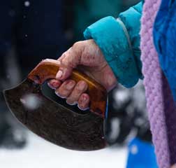
photo by author_ Jessica MacDaniel
The Arctic is undergoing changes to the landscape due to global temperatures rising. The melting of ice and permafrost are affecting many small communities in the north. Not only are homes and communities under threat, but traditional ways of living are being altered due to changes in wildlife health and migration patterns. This master’s thesis project will look at how these factors implicate the foodscape of the community, Old Crow, Yukon of the Arctic region.
Landscape architecture can operate in expansive ways in the Canadian Arctic, and can be an asset to other professionals, and communities working with issues related to the climate in the Arctic. The profession of landscape architecture has multi-faceted ways of understanding and visualizing the landscape. By creating visual information, through reference of studies, oral histories, and on-site documentation, the historical, current and projected information of the land, its patterns, and systems can be illustrated. This project will investigate how landscape architects can create information to be used as communication tools by working with community members and referencing research from other disciplines. This project will develop visual maps, timelines, 3D models and diagrams that can be used as tools for community members wanting to speak about the climate threats that they are facing, and will continue to face. This can allow for discussions between communities, researchers, and decisions makers. The visual information produced through this project will be given to the Vuntut Gwitchin First Nation community in Old Crow.
The intent of this project is to explore how landscape architects can work towards assisting communities in finding solutions to adapt to food sources changing in the Canadian Arctic’s Tundra landscape.
Updates_ Mises à jour
2019.07.12
Jessica has completed her thesis UBC SALA MLA (attached below). This project seeks to explore possibilities for landscape architectural modifications in
the arctic. The objective was to understand the challenges of climate-related changes through the lens of indigenous community. Climate-related changes are making access more challenging, dangerous and completely inaccessible at times.The design portion of the Graduate Project was to consider human mobility in Vuntut Gwitchin Territory in the future.
> Jessica MacDaniel MLA Thesis
FR_ VISUALISER LES EFFETS CLIMATIQUES SUR LES RESSOURCES ALIMENTAIRES DANS L’ARCTIQUE CANADIEN / Bourse du Fonds de recherche sur le Nord
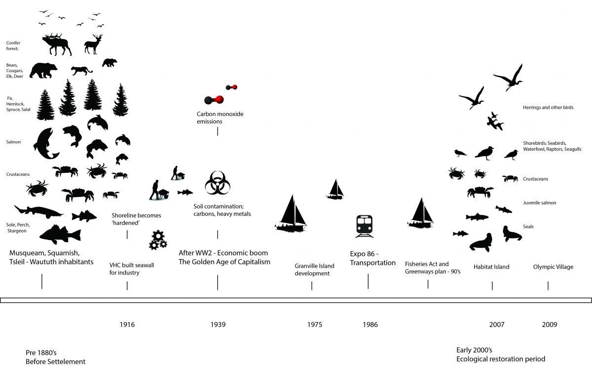
Image by author, historical analysis of Northeast False Creek in Vancouver
Le paysage de l’Arctique subit des changements en raison de la hausse globale des températures. La fonte des glaces et du pergélisol affecte de nombreuses petites collectivités du Nord. Non seulement les habitations et les communautés sont menacées, mais les modes de vie traditionnels sont aussi modifiés en raison des changements affectant la santé de la faune et les schémas de migration. Ce projet de thèse de maîtrise examinera comment ces facteurs influent sur le paysage alimentaire de la communauté Old Crow, au Yukon, dans la région arctique.
L’architecture de paysage peut agir de façon globale dans l’Arctique canadien et constituer un atout pour d’autres professionnels et les collectivités qui s’intéressent aux problèmes climatiques dans l’Arctique. La profession d’architecte paysagiste offre de multiples moyens de comprendre et de visualiser le paysage. En créant des informations visuelles, en faisant référence à des études, à des récits oraux et à de la documentation sur place, il est possible d’illustrer l’information historique, actuelle et projetée de la terre, ses modèles et ses systèmes. Ce projet examinera comment les architectes paysagistes peuvent créer des données servant d’outils de communication en travaillant avec les membres de la communauté et en faisant référence à la recherche d’autres disciplines. Ce projet permettra de développer des cartes visuelles, des calendriers, des modèles 3D et des diagrammes qui peuvent être utilisés comme outils par les membres de la communauté concernés par les menaces climatiques qu’ils doivent gérer. Cela favorisera les échanges entre les communautés, les chercheurs et les décideurs. L’information visuelle produite dans le cadre de ce projet sera transmise à la communauté de la Première nation Vuntut Gwitchin à Old Crow.
L’objectif de ce projet est d’étudier comment les architectes paysagistes peuvent aider les collectivités à trouver des solutions pour s’adapter aux changements des ressources alimentaires présentes dans le paysage de la toundra de l’Arctique canadien.

photo by author_ Jessica MacDaniels

